
Actionable mining intelligence at the pace of production
Realtime, geo-referenced 3D scanning that boosts production, eliminates waste, and reduces risk.

Top mines choose Mine Vision Systems


Real-time underground mapping. Simplified.
Trusted across underground operations, MVS solutions deliver decision-ready 3D data to drive action. Reduce uncertainty, build operational confidence, and improve safety while reducing dilution and improving recovery.


Trusted by global leaders in underground mining
Top mines use Mine Vision Systems’ precise, efficient, and geo-located data capture to support daily planning, execution, and confident decision-making underground.
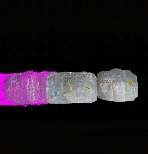
Integrated from Capture to Insights
Most Mine Vision Systems customers see a 7-figure impact within 12 months, with many achieving at least three common value drivers in their first year.

Innovating Globally
Mine Vision Systems supports underground operations across the globe.

Ready to get started?
Let's connect and discuss how Mine Vision Systems can dramatically improve your underground mapping workflows.